Friday, February 28, 2025

 French Pass and Beyond

Our time here on the South Island is coming to a close.  We have been so busy since our last post.  We have a few days before we catch a ferry so I wanted to get the blog caught up. 

We left Pohara and returned to Motueka. It was the place where we knew we could get all the supplies we would need once we left the main road. The next several days would be on narrow and twisty roads. We were hearing of high winds coming and we didn’t know what this would mean for circumnavigating d’Urville Island. It has a cape that extends out into Cook Strait, Cape Stevens..Rounding it is always iffy. Think “Brooks Peninsula.” The best time to round it would be at a slack tide with low winds. We were not sure that we would get those conditions. At the other end of the island, near the launch point is a current feature , like Deception Pass, called French Pass. Need to time that right as well. We had quite a few challenges above just the weather and timing. We had to find camp sites that would accommodate our group size. 

Map of d’Urville Island. 

French Pass in the distance

In the end, after much discussion the decision was made to camp in French Pass for a few nights and take a day paddle to a cafe in Catherine Cove. It was a good decision because the wind did come up the following day. We had a group of impressive Manta rays that visited the beach each day looking for hand outs. We have so many pictures of them but I think this picture of Marty gives an idea of the size. 


With the threat of bad weather we headed to Elaine Bay. It was pretty protected, but we still got hit with some weather. The campground itself was absolutely stunning. We had views and there were several very nice hikes we could walk if we couldn’t or didn’t want to get out on the water. It has been, so far my favorite campground (although the one we are in now is a close second). We also had rays at this site and they were varied.

A different species of ray. 

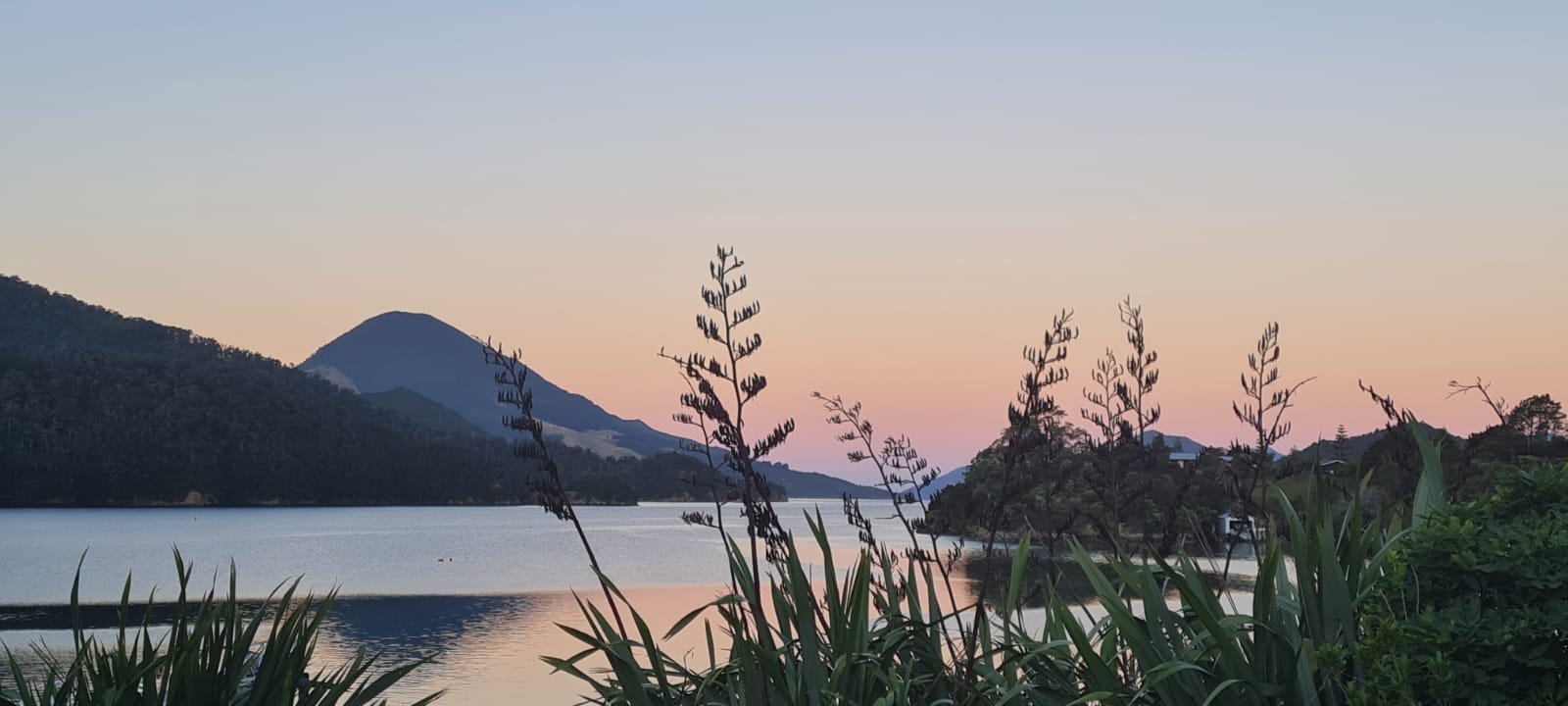
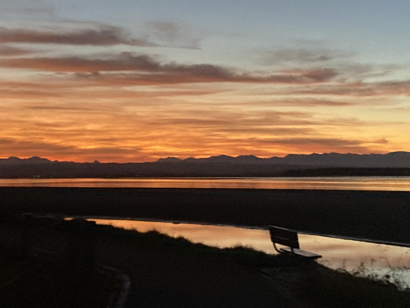
Sunrise at Elaine Bay


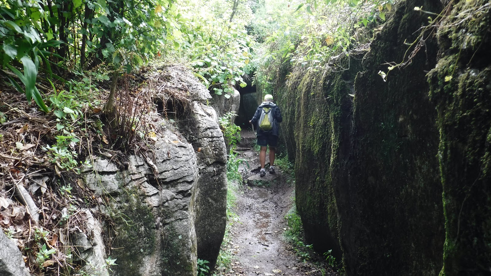
A view from Arther’s Trek, near Elaine Bay


Finally it was time to leave Elaine Bay and point our heads toward the North Island again. We got out of camp and drove 30 minutes to Okiwi Bay. We put in at 11:00am and paddled about 10 miles along incredible rock formations and cliffs. After playing for a long time we knew we needed to quit or we would never get down the road. There was always something more around the corner. We went through slots and caves. Marty got most of it with his GoPro. Maybe someday we will post it on our YouTube channel. 


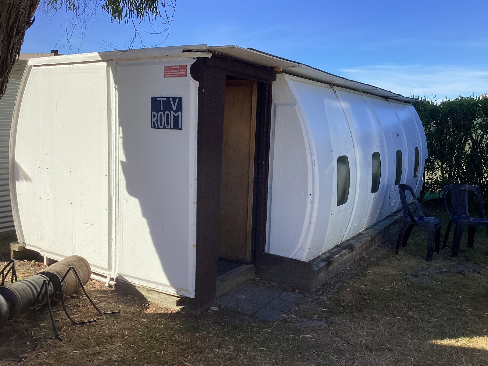
We spent last night cleaning up, doing laundry, scratching too many to count sand fly bites, and reorganizing the car. For the next few nights we are in Waikato Bay Holiday Park. Did I mention how cool this park is. The TV room is an airplane fuselage. We are in a super cute cabin.


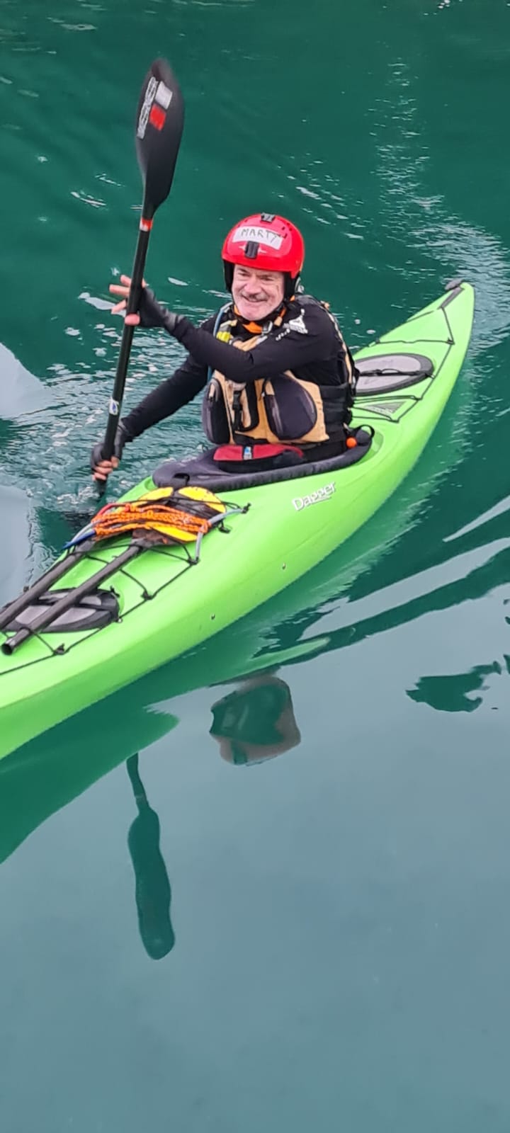
 We’ve done more cleaning of gear and are planning our next moves. We will update again.  I’m going to close with this picture of Marty’s form. It’s pretty much perfect and the boat was doing exactly as it should. Catch you all later. 


Tuesday, February 18, 2025

 KASK: The Main Event, (sort of)

KASK was the main reason we headed to NZ this year. For those of you who don’t know KASK is Kiwi Association of Sea Kayakers. Every 2 years they put together a large gathering for teaching and just plain good fun. We went to KASK in 2020 just before Covid closed down the world in the Bay of Plenty in the North Island. This year KASK was held in Nelson on the South Island at Tahunanui Beach Resort. The claim to fame is that the holiday park where we camped is the largest camping park in the entire Southern Hemisphere. It was really big. On our way down I received a phone call from one of the organizers. One of the women instructors from Spain had to return home due to a family emergency.  I was asked if I would like to fill in, to coach a group of women. We were being called “Wahine on the Water” or WoW for short. With a few nerves I agreed to take it on. It was a great experience. I met some really neat women and I was encouraged all along the way by the other instructors. Marty was designated as the “weather guru.”  His job was to report the weather for the day at the morning meeting. He was pretty funny in a dry way. The Kiwis and Brits found him hilarious and every morning he would step up to the mike to a rousing ovation. It was pretty awesome. 


Wahine on Water Pod 2

There were 2 groups of women, one led by me and the other by my friend Deb Volturno. She had spotted a tiny little island in the inlet called Pig Island and claimed it for her group. Of course I’m just a wee bit competitive so I told my group that we needed to get there first. Of course we did get there and we had photos to prove it.  


My group was so excited that they had planted their flag on Pig Island. It was a bonding experience. I found that the women here are so excited to learn new skills. We really are pretty lucky with the amount of training that is available to us. 

Sunset over Nelson

We are going to spend the next week checking out a few beaches with a group of paddlers then it is off to D’Urville Island. This is an island that many Kiwis circumnavigate. It can be dicey on one side of it, with tricky currents, wind, and potential swell. Should be fun. 

Our first stop after leaving Nelson was Motueka. Marty and I had stayed in the holiday park there in 2004. We were curious how much it had changed in the last 20 years. There has been some growth, but it still feels like a small town and the holiday park was improved, but still recognizable.  We camped the first night but booked a cabin for the second night when we realized that weather was coming in. Boy are we glad we did. It started to rain about dinner time and by the time we went to bed it was raining heavily. About 2:00 I woke up to strong wind. We checked to make sure that the windows of the car were up, then I kept saying,”boy am I glad we are not in a tent tonight.”

We left Motueka the next day to sunshine and wind. The skies looked threatening and we were expecting weather later that day. We had booked a cabin for 2 nights in Pohara, so we were not too worried. The road to Pohara, while one of the better ones on the South Island, was narrow, steep, and twisty. The views were fantastic. 


Neither of us got car sick, but I have claimed the wheel for the drive to French Pass. Today we drove to the end of Farewell Spit. We had planned to do a walk on the spit, but after just a few minutes on the beach my legs were covered with sand flies. I have just stopped itching my ankles from the last bout of sand fly bites. So we took a few photos and headed to a cafes in Collingwood. 

Farewell Spit in the distance

On our way out to the spit we were reminded of the roads that we had ridden on 20 years ago. It is a place of single lane bridges. Today we crossed one that was quite long. A sign lets you know who has the right of way, but you have to trust that the oncoming traffic will respect that. 


On the way back to Pohara, we stopped at Labyrinth Rocks. It was fantastic.  It is a park of about 5 acres full of limestone canyons, tunnels, and named natural formations. We took so many pictures that I can’t include them all. Here are a few to give you some idea. 


Tomorrow we start the trek towards d’Urville Island, moving as slowly as possible. We may be out of range for a bit. Will catch up soon. 

Monday, February 17, 2025

Coromandel and the Road South


 Greetings from New Zealand again! Sorry this took so long to get out .... We are distracted!

We left off in Hahei after some amazing paddles, and decided to go to the west coast of the Coromandel Peninsula and try to get to the top, Port Jackson. Well, we got talked out of it.. The road is terrible and under construction. The wind was really strong that day, so we most likely would not get to paddle. So we relaxed and explored the area.

We drove to the end of the paved road, Colville. Not much there, but one Cafe and a lot of scenery. 

                                                   Colville, at the end of pavement.


One last Coromandel scenery photo, near Manaia 10 km south of Coromandel city.


It is hard to describe driving here, so we thought a video would help!


If the embedded video doesn't work here is the URL:

https://youtube.com/shorts/8tzAZXHbtaA?si=-_JWjItfQcTEYmiM

There are few freeways here, so it takes longer to go anywhere. It is also road construction season, and the detours are an adventure in there own way.

Back to working our way from Coromandel to the south island.

 It took us two days of driving to Wellington, where we would ride a large ferry to Picton on the south island. 

We stayed in Wellington one night, walked around the waterfront the next morning,  and headed to Picton on the south island. 


                                           Esther and a friend leaning into the wind.

The Massive Ferry 

Approaching Picton

 The weather was great for the crossing of Cook Strait, and the ride was sceanic and smooth. 

At last! We are back on the south island. We were last here in Picton in 2004. We remembered some, but things have changed. We stayed in Picton one night, one night in Havelock, then off to Cable Bay.

Cable Bay is a tiny village at the end of a road where the first Trans Tasman sea telegraph cable landed in New Zealand. Currently it is a Cafe, holiday park, and a beach with a boat launch. 

Cable Bay


Pepin Island is here, which is yet another great kayaking location. More caves, rocks, and stunning vista's. I would recommend timing the paddle with the tides better than we did.....

Paula in the waterfall cave on Pepin Island


Well, we've played around as much as possible, and it is time to head to Nelson and KASK. We will cover that in the next post
Soon!
E & M


Saturday, February 8, 2025

Coromandel and the Bay of Plenty

 The last week has flown by. We have gone north to the Coromandel Peninsula to explore and play. We have been staying in campgrounds, and the weather has been near perfect. Campgrounds are interesting places, and we always meet interesting people. There are many people like us, traveling on long trips and living in less expensive lodging (Smile).

The camping life and three day rule: We have learned that it takes three days to organize when on the road. The first couple days everything is lost, hidden, or buried.  But after three days, poof! You can find everything quickly.

 Driving here is very stimulating. You drive on the left hand side of the road, and the roads are very winding and narrow with the locals driving fast. It is truly a team sport, and is hardest on the passenger. On the left (passenger) side, you always feel like you are driving off the edge. It is getting better slowly, and we are still talking to each other.

Our first stop on the way north was Whangamata. We are tenting for the first time, and kayaking to some small islands. It was a good test to try our tent and kayaks out.


We paddled around all the islands, but Donut Island was the most fun. It had a large daylighted cave in it, and it was impressive. 

Marty inside Donut Island

The doorway out

Some fun things:


The next stop was the village of Hahei. We spent two days on the water here, and stayed in a large holiday park on the beach. The first paddle was to see a large tourist attraction, Cathedral Cove. The cove has a large sea arch that you can explore from the beach. It is hard to get to, as the shore trail to it was destroyed by a large storm.

Cathedral Cove

It was fun to watch the tour guides launch the large tandem kayaks off a steep beach into 1+ meter swell. It was like an aircraft carrier.


Kayak tourists being launched off the beach.

Our final trip out of Hahei was the Hot water beach. This was a about 3.5 miles along rugged coast. It is hard to summarize this section... It was amazing. We found at least a dozen caves, and explored at least six. One large one was daylighted, and was larger than donut island.  The paddle started as we headed to a point, but then noticed a 20 meter tunnel through the point. It was like entering another world.

Here are some highlights:
Hope that rock doesn't fall...

Esther 

Entrance to large daylighted cave

Love that color

Looking up inside

Really large cave

Even bigger cave with a boat in it.

Large cave with a stone column at the entrance

Inside that cave
Wow... what a day
So, it's late and we need to get up early to catch a ferry.
More soon!
E & M