Saturday, July 27, 2013

Off to California!

7-25-2013 Union Creek to White City, OR
The next part of the Adventure Cycling route goes up into remote steep areas with no services for about two days. There is just nothing there. We thought about it and decided to head down to Medford on route 62 instead. Maybe we are getting soft, but we are also getting wise. And we don’t do wild camping (Smile). 
It was mostly downhill to Medford, but really warm toward the end.
Rouge River in Prospect, OR

Lunch in Joseph Stewart State Park

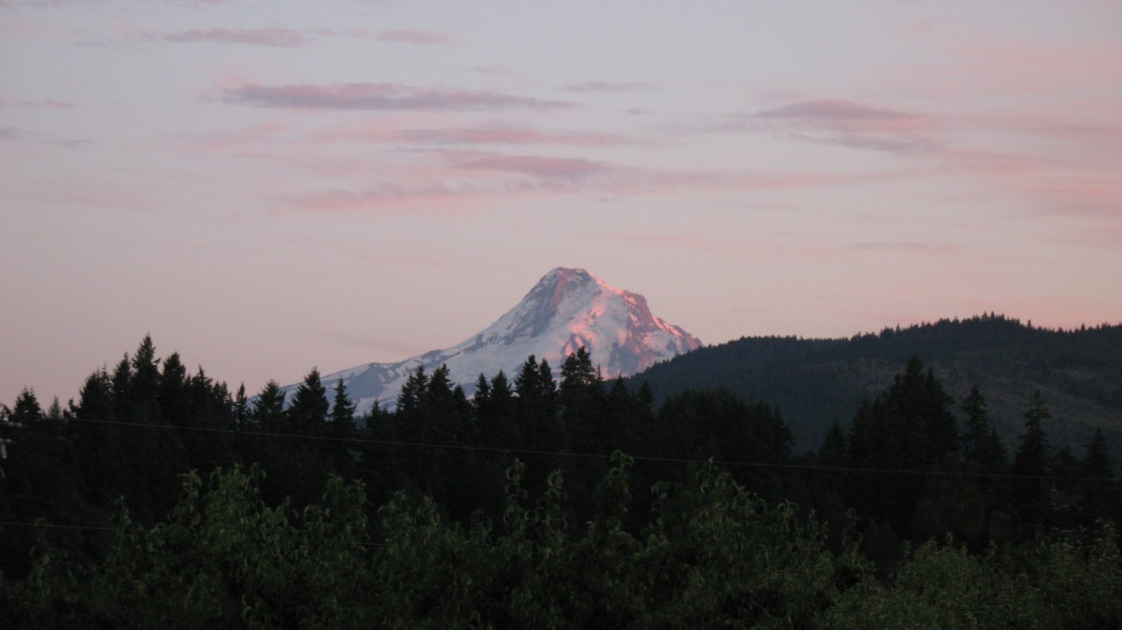
Lost Creek Reservoir from Rt 62 bridge

We took route 62 down to Eagle Point and stopped in a visitor center for lodging information. It was about 100 degrees outside, and we were melting. We found a room near the Medford airport in White City. We figured the tent would be really hot until 4AM, so we would sleep better in a room. We did plan to take a day off in Ashland, so we have a short day tomorrow and Saturday off. Good thing, as the weather forecast is for 100 degrees Friday and cooling off to high 80’s after that. One other thing has come up, and that is red flag warnings for forest fires. That could change our trip dramatically. We’ll keep you posted.

7-26-2013 White City to Ashland, OR
A little urban exploring today. We had heard of the Bear Creek Greenway yesterday from a local in Union Creek. It is a 20-ish mile long bike route from Medford to Ashland. We got a flyer for it from the visitor center and off we went. We found a lot of homeless people hanging around it in Medford, and some of the locals warned us about them. No worries, they were just part of the local picture. We stopped at AAA to get some California maps and we were in Ashland by mid afternoon. We found our Motel and a little Mexican restaurant and all was well. I have been hungry for the last week, and this is one time that I can eat as I feel. I just need to keep cycling.


7-27-2013 Ashland, OR
A slow day. We walked to downtown and looked around. Ashland is home to a Shakespeare Festival, which goes on all summer. We visited one theater and walked around the park next door. 
Main Stage of the Elizabethan Theater

The air here is hazy, maybe due to fires to the north of us. It seems to be clearing up as the day goes on. Ashland is also home to Southern Oregon University. It reminds us both of other small colleges. A nice little college town. 
Southern Oregon University

Tomorrow we are off to head into California via Siskiyou Pass. We are getting close to 800 miles. That seems to be going fast! And the wildfire situation seems to be better today, with some rain to the south of us yesterday. Good news.

Friday, July 26, 2013

Cooking in Ashland

Hello from southern Oregon! We are taking a day off and have all the key ingredients for blogging: Power, internet, and time. It has been really hot down here the last two days (100+ degrees). But we are in a room with AC, so all is good.
So lets get caught up.

7-21-2013 Bend to Lava Lake
Back on the road again! Today we climbed up to the Lakes region above Bend along the Cascade Lakes Highway. This area has lots of people who climb from Bend to the Mt. Bachelor ski resort on bicycles. Esther was happy to bug people by climbing her fully loaded touring bike as fast as them. Just give her a rabbit…. 


Mt. Bachelor from Rt. 372
Most all of the day trip crowd was gone after the ski resort, and we ended up at Lava Lake about 45 miles from Bend. Lava Lake has a forest service camp ground right next to a resort with a store, showers, and small marina. It is good for us because we can camp with full services at Forest Service prices. It gets very cold up here at night (40’s), so it is good sleeping weather.

The South Sister from Lava Lake
7-22-2013 Lava Lakes to Crescent Lake, OR
We went from Lava Lake to Crescent Lake today. The traffic today was very light, maybe a couple cars an hour. Nice relaxed cycling with only a little climbing. It did get hot today (90’s?), and we were tired at the end of the day. 
Upper Deschutes River below little Lava Lake
Cascade Lakes Highway near Davis Lake


Crescent Lake is another resort coupled with a Forest Service campground. We were too lazy to go two miles to the showers, so we sponged off in camp. We had a water front camp site and it was nice. The water is very clear in the lake. It is quiet up here at night, and the stars are bright.

Crescent Lake from our camp
7-23-2013 Crescent Lake to Lemolo Lake
Today we took a back-road route to Lemolo Lake today, Forest Service road #60 over Windigo Pass. The 60 road is mostly not paved, and is in poor condition. 

Leaving Crescent Lake that Morning
FS road 60 at the end of the pavement

The hot dry weather has made the road very sandy, like a beach. We had some thoughts about turning back after walking some stretches. We did persist, and we got better at beach cycling. The road is very rough at the top, and is pure four-wheel country. 
60 Road near Windigo Pass

The surface was harder, so we could ride over it easier. 

We made it!

The decent down was bad due to steep grade and a soft surface. We were very happy to get down to a paved road. 
The 60 road going down

We got to Lemolo Lake and ended up in a lodge room for the night. We were both beat up and tired after the ride on the 60 road. As a side note, we tried another back-country route to Lemolo Lake in 2007 using the 700 road. It was a disaster and we didn’t get to the resort till about ten at night. But that is another blog.

Mt. Thielsen over Lemolo Lake at Sunset
7-24-2013 Lemolo Lake to Union Creek
This was a hard day with some of the best scenery yet. It also had something else we have seen very little of, cloudy skies and even some drizzle! This worked in our favor since we climbed up and over Crater Lake. We have cycled up to the Rim village before, but this was the first time with fully loaded bikes. The cooler weather was nice, and we had no problems. 
Piece of cake!

Wizard Island in Crater Lake
Colors of Crater Lake
Crater Lake Rim Road

We stopped and took many pictures, and got concerned about the time. Our plan was to cycle down to Prospect, but we could not find lodging. We instead went to Union Creek, and again found a resort next to a Forest Service campground. Along with the beauty of Crater Lake, the decent to Union Creek along Rt 62 and the Rouge River was wonderful. Quiet road, large old growth trees, and the noisy Rouge River nearby. The river drops steeply and through a gorge near Union Creek. Very beautiful. 
Rouge River Chasm

Route 62 also drops at just the right grade to average about 28 miles per hour almost all the way. The 24 miles from Rim Village to Union Creek took about 70 minutes. Got to camp with time to eat dinner at Beckie’s restaurant, and have some world famous pie. The Forest Service camp sites are huge, and this campground was really nice in old growth fur and next to the Union Creek. We have had a full moon the last couple of nights, and that really is nice in the woods at night.


Saturday, July 20, 2013

Having Fun in Bend

Want to see something fun? Watch this....


This is a video of the Cascade Classic Mens Pro Crit race in Bend tonight. Very fast. I was exhausted just watching.
Well, we are off again tomorrow. We've rested, had some really good food, did laundry, poked around Bend, watched 6 bike races.... We are ready to go. Up to Mt. Bachelor tomorrow. We'll be in touch.

Friday, July 19, 2013

Yikes! Time flies. This should get us caught up.
7-13-2013 Odell, OR to Government Camp, OR.
We knew there would be climbing today, but man… We got our first sign of what kind of day we were going to have early, when we found both of Marty’s tires flat. I had ridden over a lot of junk on the side of I-84 yesterday, and found a plastic tab with a staple hanging off the front tire at a rest area. No big deal, I removed it and the tire held air, so those expensive tires did their job! It did create a slow leak in the front which flatted overnight, and the rest of the staple got through the rear tire and flatted it. I was glad it held to the B&B. Just as a side note, we rarely ever get flats on these trips. One or two flats in a 6 week trip is normal. So after a large great breakfast at the Pheasant Valley B&B, we repaired both flats then set off up the valley through Odell, Dee, Parkdale and on to Rt. 35 towards Government Camp. 
Mt. Hood near Parkland, OR
Mt. Hood Railroad at the Parkland Depot.

We spent just about all day climbing Bennett Pass, about 31 miles. We got some great views at the top then we had a short decent to Rt 26 and the climb to Government Camp. That last three mile climb into Government Camp cooked our .. ahh Goose. 
Welcome sight, Bennett Pass Summit

Rt 26 near Government Camp is like I-90 westbound near Thorp on a summer Sunday afternoon; Busy, thin and plenty of attitude. We made it, stayed in a room and ate fish tacos to recover. Biggest day of climbing yet! (4087’) 

7-14-2013 Government Camp OR to Detroit OR.

This was a long day (72 miles) with plenty of climbing (3446’), but more importantly there was over 30 miles of descending! This leg was on rural Forest Service roads and we saw almost nobody all day. We left Government Camp and headed south on Rt. 26, then turned on Forest Service road 42. This road was recently improved and the paving was perfect. The road climbs steeply to Timothy Lake then bounces along for miles, passing through the Clackamas Meadow area. 
Clackamas Meadow
Forest Service Road 42
The Old Clackamas Ranger Station

The Clackamas Meadow ranger station is a preserved 70 year old ranger station. The road shrunk to a single lane with turn-outs, and the last eight miles was a steep descent. We gladly traded sore legs from climbing to sore hands from gripping brakes. We saw 2 vehicles on this one laned stretch. A logging truck which we yielded to and a shiny red convertible driven by a man in mid-life crisis which we made slow down to pass us. We finally got to the FS 46 road, which after a climb over a ridge, descended for the last twenty miles into Detroit. We love long descents at the end of the day, especially if they are not real steep. Detroit is a sleepy little town (Population 279) on the end of Detroit Lake. After looking around and not finding the campground, we got a room at the local motel and ate at the local restaurant/gas station/grocery/sports store. 

7-15-2013 Detroit to Belknap Springs, OR.
Today we rode route 22 from Detroit towards Santiam Pass, but turned south on route 20 and then to route 126 (Alt.) to Belknap Springs. Route 22 was a two lane fast freeway-like road, with trucks and all. 
North Santiam River from Rt 22

The adventure Cycling route takes you to Sisters over Santiam Pass, but we wanted to go over McKenzie Pass to the south because it is quiet and shady. It is getting hot in the afternoons here, so shade is important.  We camped at a fancy RV resort at the foot of McKenzie Pass. This area is famous for its mountain biking, with the McKenzie River Trail being the center piece of it and it’s natural hot springs. The resort is called Belknap Springs Resort and has 2 hot spring pools. It would be a nice place to get a cabin or room and just relax for a few days. We had a huge tent site, larger than the RV sites! It was fun to talk to the mountain bikers. They were impressed with our bikes and all our gear.

7-16-2013 Belknap Springs to Sisters, OR
Today we rode Rt. 242 up and over McKenzie Pass. We had cycled this before, maybe 2005? The road has been repaired and it was sunny and warm. As a special treat we got to watch the Cascade Classic Pro race fly up the pass past us.  (We were well off the road, instructed by police escorts) The men had a five person breakaway several minutes off the front. I felt old and fat watching them fly by. 
Pro Men Breakaway
Pro Men's Peleton

The real impressive one was watching a breakaway start in the Pro women race. Wow. 
Flying off the front

My goal was to make it up to the top before the course crew pulled the KOM (King of the Mountain) sign. We got close, but we saw the truck go by just minutes from the top. If only we could have hung on to the main field for a few more minutes…. The top of the pass is like going to the moon. It is covered by a hundreds of years old lava flow and has great views. 
McKenzie Pass Summit View

At the top is an incredible observatory built from lava stones which points out all the visible peaks.  
McKenzie Pass Observatory
We did it! 

The descent down to Sisters was nice and fast with good pavement and almost no cars. We are getting into eastern Oregon now, so the trees are thinning out and the view is wide open. It is also getting hot! I haven’t said much about the weather because it has been the same for the last week or so: Sunny and warm with light winds from the northwest. Camping in Sisters used to be hard. The local RV parks are out of town and don’t really cater to tents, and the city park which had a lawn and a toilet. The city of Sisters has now improved the city park to an attended campground with showers and biker sites! It was really nice and clean and cheap.

7-17-2013 Sisters to Bend, OR.
Today is a short day from Sisters to Bend, where we will take a day or so off. Adventure cycling has you take route 20 to Tumalo, then side roads into Bend. Rt. 20 is a busy two lane road with one meter of shoulder. Yuck. But we met a really nice Sisters resident who gave us the route to Bend using back roads. Great work Doug! It made all the difference. We also rode some of the race route and I remembered it! I rode in the Cascade Classic in 2003 (In the mortals division). The hill climbs near Tumalo in particular. We climbed out of there today in the mid afternoon with no shade and 90+ degrees. But we were soon in Bend eating ice cream to cool off. No worries. We found our Motel and sat in the AC to cool off. Better…..
The Sisters from Cloverdale Rd.

7-18-2013 Bend, OR.
Well, we have been riding pretty hard for the last eleven days. We’ve ridden about 500 miles with 26000 feet of climbing. It’s time for some rest. We have several things figure out. The campsites after Bend are busy on the weekend, and may not take us in if they are full. Bend is busy this weekend due to the bike race. So we decided to spend three nights in Bend to stay out of the woods till Sunday night and rest up. We will have to watch the Cascade Classic Crit races there Saturday night. Dang. 

Saturday, July 13, 2013

7-13-2013
Hi everyone!
We have been out in woods and out of touch, so I try to get you caught up. We wanted to start out in a more gradual way, so for the first few days we shortened the route a little to warm up.
Last Wednesday we left Ashford and took the Skate Creek road to Randle. Just like the last few days, the weather was perfect.
Mount Rainier from Skate Creek

The ten mile climb was no big deal, and the road was quiet. We stayed at an RV “resort” campground near Randle. It had a golf course and we were able to watch approach shots to a green from our tent site.  
The next day we tried a real test, Randle to Eagle Cliffs. This was a forty five mile up-and-over to the Swift reservoir on the 25 road. We did about a twenty four mile 3600’ climb with the last four miles over ten percent grade. We did just fine. Esther’s foot is not going to slow us down. The 25 road goes south between Mount St. Helen’s and Mount Adams. It is very scenic and quiet with just a little bit of helicopter logging (Smile). Just past the Swift reservoir we stayed at a small campground named Eagle Cliffs that is truly off the grid. It had 24hr water pressure, but the generator was turned off at 6PM so the office/store closed, and all the lighting was turned off. I brought a lantern in to the shower room for light. It was really dark at night there. We also had no cell phone coverage since Randle, so we left our phones turned off.
 In honor of the great bike trip Pete, Geoff, and I took to Yellowstone, we cooked up some “Flathead Lake Special” at Eagle Cliffs. This special treat is made from canned chili, ramen noodles, and canned corn. It was delicious!
The next day we left Eagle Cliffs to head down to Stevenson, WA. We had to climb out of the Swift reservoir area, and that climb started as soon as we left camp. It was shorter than the previous day, but still very steep.
Mt. St. Helens from the 25 Rd.

Curley Creek Road 

The good news was the 30+ mile decent toward the Columbia River down Wind River road. We stayed on the river at a camp ground and enjoyed the sunset.
We left Stevenson WA today and crossed into Oregon at Cascade Locks. We walked over most of the Bridge of the Gods due to the steel grated deck on the bridge. Esther did not want to risk a hard landing on her foot. 
It was a great view from the bridge. 

 We had a hard time finding a place to stay near Hood River. We ended up tonight in a B&B in Odell OR. The B&B is on a Winery south of Hood River. They grow apples, pears and grapes here, and the locals are nice. 
Sunset at the Pheasant Valley Winery
We are going to get a nice breakfast tomorrow, which we will burn by cycling to Government Camp. I don’t think it is very steep, but it will be a climb most of the day.
Esther and I have biked in this area several times before and it is a favorite of ours. You have great views of Mount Adams and Mount Hood from here and it is all agricultural. Nice quiet farm roads.
We will be in rooms more in the next week, so you will hear more from us.

Tuesday, July 9, 2013

Hello out there in radio land!
We thought we would send out a quick post from the road, tonight from the Whittaker Bunkhouse in Ashford, Wa. Although we are outnumbered here 150 to one by climbers, they all DROVE here!  We left home yesterday about 10AM and went through the port to Fife, and caught the trail in Sumner. We took the trail to Orting, then rode Orville Road all the way to the end, at the city limits of Eatonville. Too bad we missed our turn to the campground and had to back-track eight miles to Tanawax Lake. It was so nice though. I was thinking yesterday about what Willie Weir said, "Leaving on a long trip is like launching the Space Shuttle". How true... We are heavy due to the extra gear and parts carried for long trips. We still have room for food (Smile).

 Esther is becoming a folk legend for riding a fully loaded touring bike with a broken foot. She can ride just fine, but it hurts to start and to walk. That is my girl.
It is fun to see all the folks getting ready to climb Mount Rainier. Hmmmm. Sound dangerous. Of course we had our moments today. Route 7 is closed today between Eatonville and Alder Lake, so the quiet little Alderlake Cutoff  Road was the main highway today. Many many tandem dump trucks, logging trucks, and impatient car drivers made the 10 miles a harrowing ride. We made several stops to rest and regroup. That six inches of shoulder is very narrow. After renewing our faith in a Higher Power, we enjoyed the rest of the day.
 Alder Lake is high right now from the fast melt and has that teal green color from the glacier till. It is hot here and it ground us down. We took our time from Alder Lake up the long false flat to Ashford. We planned to stay here and it was a welcome site. After a quick dinner and laundry run, we could relax and ice Esther's foot. Tomorrow we will go over Skate Creek road to Randle, then two days up and over the 25 road to the Columbia River. I think we are off to a good start.

Wednesday, July 3, 2013

Here We Go Again

Has it really been since 2009? I have so needed/wanted this vacation. So much so that I am going to go broken foot and all. Yes, I broke my foot last Sunday. Stepped in a hole while loading kayaks.
Good thing cycling shoes are stiff soled. 

Marty has been laid off since the end of March. No problem we thought. He was called back to work last week. Can you believe that? We decided that we would go anyway and Marty's employer graciously gave him leave for the 7 weeks. 

So the plan is to ride to the San Francisco area via the Cascade-Sierra Mtns. We will visit Erin and Elisa, my nieces. I'm excited to meet my great nephew Apollo, Elisa's one year old son. Oh yeah, it will be good to see the girls too and to meet Apollo's daddy, Justin. 

So stay tuned and we will keep you posted.